Pilot
Sweden
Gothenburg
Managing industrial legacy of contaminated land by soil-inclusive planning
Gothenburg is Sweden's second largest city and covers an area of approximately 448 km² on the west coast of the country. The Göta Älv river runs through the city and flows into the Kattegat sea. The area shows signs of Mesolithic settlement and was of strategic importance as early as the 14th century. Gothenburg was officially founded in 1621 and built with the help of Dutch engineers, whose influence can still be seen in the city's canal system.
During the 18th century, the city became a hub for international trade through the East India Company and the export of iron and timber. In the 19th century, industrialisation and the expansion of the port infrastructure transformed Gothenburg into a major industrial city. Although the shipbuilding industry has disappeared, Gothenburg remains Scandinavia's largest port for container shipping and trade.
Today, the city combines dense urban development with extensive green and natural areas. Regeneration projects have transformed former industrial areas along the river - such as Lindholmen Science Park and Norra Älvstranden - into vibrant mixed-use areas. Urban expansion now focuses on reclaiming central waterfront areas for high-density development, with sustainability as a guiding principle. The surrounding landscape consists of rocky ridges and clay plains shaped by the last Ice Age. Thick marine clay deposits dominate the urbanised valleys, while the coastline transitions into an archipelago. Land uplift (about 3 mm/year) still exceeds sea level rise, but is partly offset by local subsidence.
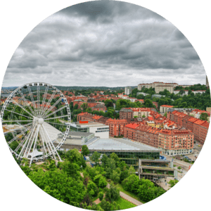
Aerial view of Gothenburg.


