Soil and Hydrology in Romania
Recently, Romania has been facing one of its most critical hydrological alerts. The National Institute of Hydrology and Water Management issued Code Red flood warnings for 12 counties, highlighting the imminent danger of flash floods, significant slope runoff, and overflowing rivers. These extreme events serve as a stark reminder: climate resilience starts with how we understand and plan our land.
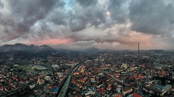
Although Baia Mare was not among the affected areas, this moment underscores a broader and crucial reality: no territory is immune, and proactive spatial analysis is essential everywhere.
In this context, the SPADES4Soils project becomes more relevant than ever. SPADES is dedicated to integrating soil health into spatial planning and design across Europe. Through 17 pilot sites, including Baia Mare, SPADES is developing tools, strategies, and knowledge to help cities and regions plan more effectively by putting soil at the center of decision-making.
ZMBM, supported by URBAN2020 Association, is working to apply & refine soil-sensitive planning tools that can enhance landscape resilience, reduce environmental risk, and improve ecosystem services like water retention, carbon sequestration, and erosion control.
As part of its technical work, the Baia Mare pilot recently analyzed land fragmentation density. This key morphometric parameter measures the total length of hydrographic features (streams, ravines, dry valleys) in relation to surface area (km/km²). This metric helps planners and scientists:
- Identify hydrologically sensitive zones
- Understand where water may accumulate
- Highlight valleys and depressions prone to surface runoff
- Pinpoint areas at risk of erosion or flooding
While this analysis does not predict floods by itself when combined with other critical data such as slope maps, altitude models, soil permeability, and land cover, it becomes a powerful tool for identifying flood-prone areas.
Because soil is more than just ground we build on—it’s a dynamic system that:
- Absorbs rainfall
- Filters and stores water
- Reduces surface runoff
- Anchors vegetation that prevents erosion
When soils are degraded, sealed, or stripped of organic matter, they lose this buffering capacity, making floods worse and droughts more severe. That’s why SPADES promotes soil-inclusive planning, ensuring that urban growth, infrastructure, and land use decisions do not ignore what lies beneath our feet.
Baia Mare was not under flood warning this time, but waiting for disaster to plan is not an option. The SPADES project demonstrates how proactive soil and landscape analysis, such as the fragmentation density method, can guide better-informed spatial strategies that support both climate adaptation and land degradation neutrality. Projects like SPADES help us ask the right questions: Where does water go? Can the soil hold it? Are we planning with nature, or against it? It’s time we start listening to the landscape.
Publishing date: